That proves that this is just the politics board lite! If Trump made some remarks about it, it would have 1000 posts on whether not to evacuate or not. lol.
Umm, guys, this is potentially Ike part 2.
That proves that this is just the politics board lite! If Trump made some remarks about it, it would have 1000 posts on whether not to evacuate or not. lol.
Umm, guys, this is potentially Ike part 2.
I’ve been hunkered down and stocked up since March lol
I just had a stand by generator installed…I was told it is a hurricane repellent.
What’s it have to do with football? Because the football board has become the new Satellite, with off topic non political posts?
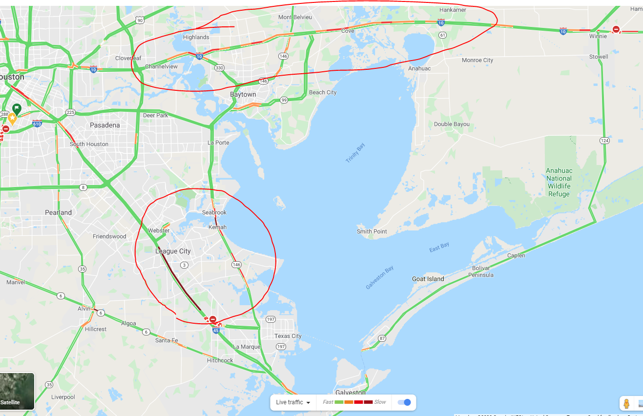
I was just let off work early. Driving home north on 45 at League City; it’s bumper to bumper. Galveston issued a mandatory evacuation order
Wish you all well in dealing with it. I thought both hurricanes were on the small side, am i wrong?
One of the best sources of info is Space City Weather: https://spacecityweather.com/
We’re still in wait and see mode, as the hurricane could continue to slide westward. However, right now looks like this will have less impact to Houston than Hurricane Ike. Also important to know it’s got zero chance of giving us Hurricane Harvey levels of rainfall and flooding.
Worst impacts to Houston are when a hurricane makes landfall west of Galveston. Right now this looks to stay well east of Galveston.
However, don’t take my word for it, keep your eyes on it and be ready for anything. We’ve got a generator (thanks Ike) and lots of noodles (thanks coronavirus).
Watching like a hawk…love the SCW guys. No hype. Really need it to go east…have property on Pelican Island. Couple of sleepless nights so far. I realize if I am spared, someone else gets hit, tough position to be in.
I think we’ll be OK in Houston area. But you’re right, somebody’s gonna get it.
Interesting to watch the traffic on Google Maps though. Lots of Golden Triangle folks heading this direction, and Galveston Islanders evacuating too.
I also like to go directly to the National Hurricane Center, lots of good data there: TROPICAL STORM JULIA
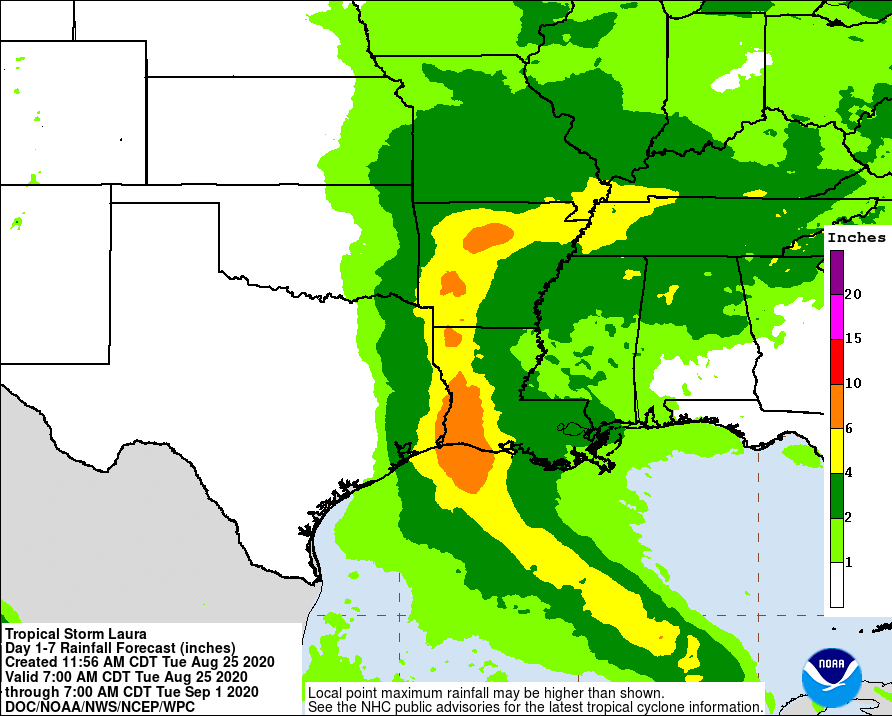
Potential rainfall isn’t a concern for Houston (1-4 inches predicted):
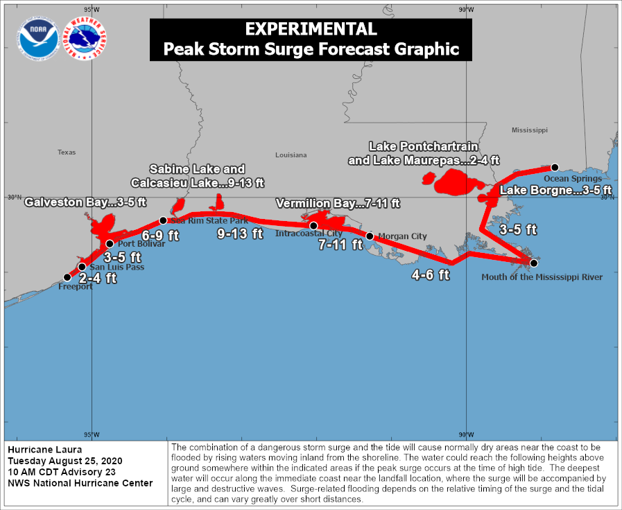
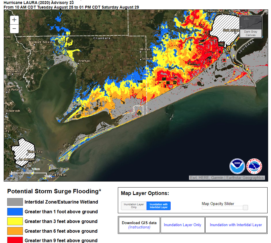
Storm surge is a concern along the coast (3-5 ft predicted for Galveston Island and Galveston Bay):
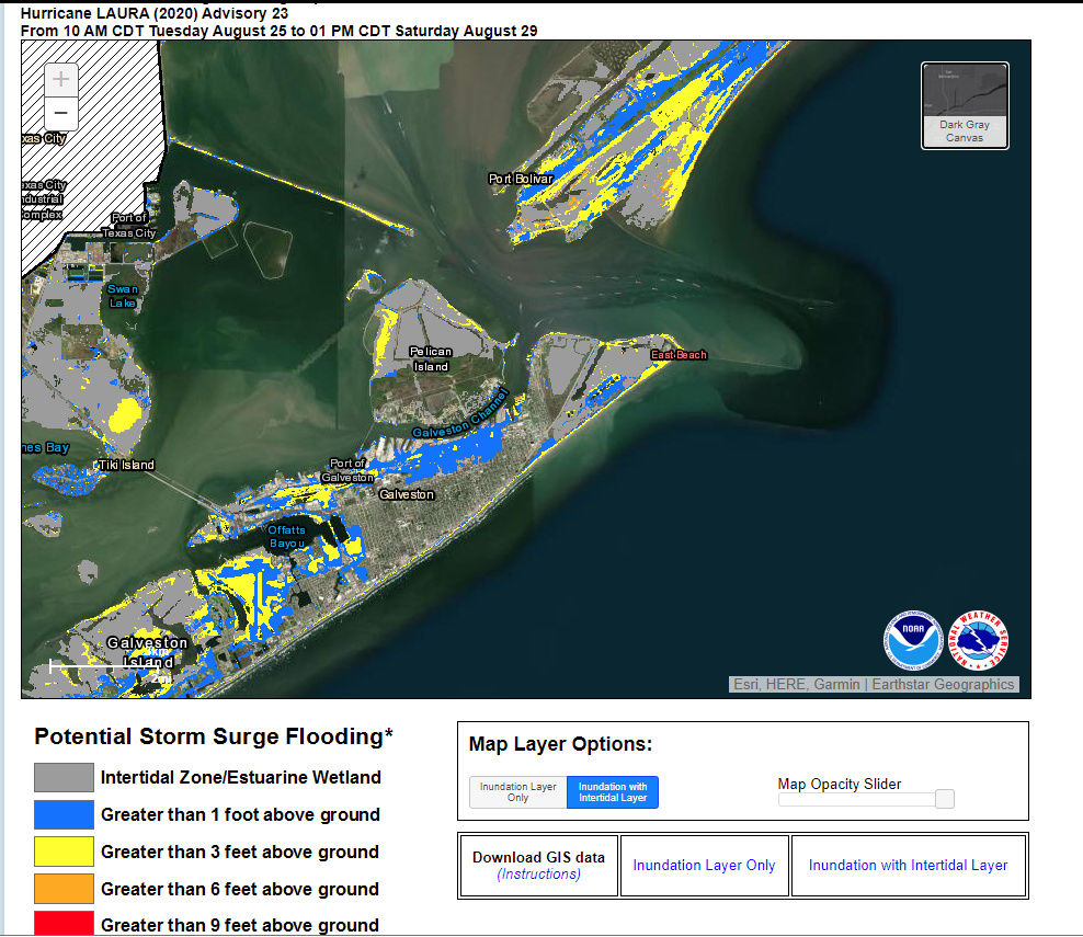
And one more to (hopefully) keep you calm. Potential storm surge flooding depths – this shows that a bit of the north side of Pelican Island will get up to 3’ of flooding, but south half of the Island remains dry.
East of Galveston Bay has a LOT to be worried about. Significant areas predicted to get more than 9’ depth of flooding. That’s not same as storm surge, this is predicted depth of flooding, taking into account the elevation of the land.
Thanks…I missed the detailed surge map…that helps!
https://twitter.com/arstechnica/status/1298314205708406790?s=20
Hah, just read that https://spacecityweather.com/, posted by TOTC is this guys website
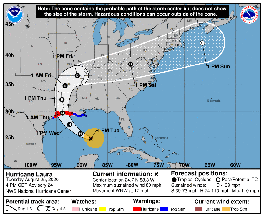
I don’t know guys. It looks like its edging west by the hour. Here’s one of the latest ensembles.
https://apps.sfwmd.gov/sfwmd/common/images/weather/plots/storm_13_ens.gif
https://twitter.com/spacecitywx/status/1298320561504911360?s=21
This a tough one to forecast. This just came in on the 1PM update. Gonna be a nail biter.
My elderly aunt and uncle evacuated from Beaumont late last night and arrived in Austin early this morning.
Glad they are safe.
My wife and I are preparing to leave and go get my Mom, if necessary, but at least at this time, Katy appears to be safe.
My wife shared school is cancelled in her district for the rest of the week.
But they they are already at home, I pointed out.
To give families time to prepare is the reason.
NHC 4pm forecast is out. Looks like the same track to me… Right up the Sabine River.
Houston still right on the edge of the forecast cone.
based on what I am seeing it looks like the target for the storm center will be at Trinity Bay between Baytown and Beaumont. Houston will get the left hook of the storm.
https://twitter.com/houstonoem/status/1298581286299340802?s=21
Possible Cat 4 at landfall. TX LA border still projected landfall.
Praying for the Golden Triangle area, Cameron, Lake Charles and let’s all hope that this hurricane does not go West or directly hit New Orleans.
©Copyright 2017 Coogfans.com